
The town of Beverly Shores includes part of the Indiana Dunes National Park. (Photo credit: David Mark, Pixabay)
The record high Lake Michigan water levels in 2020 were even more dramatic if you consider that the lake had near record low levels as recent as 2013.
“That’s a lot of pressure on the shoreline,” said Cary Troy, Purdue University civil engineer. “There’s really no precedent in terms of ocean coastlines for what the Great Lakes are going through related to water level fluctuations.” In addition to lake levels, beaches are impacted by large storms and barriers, piers, and other human interventions.
Troy is part of a sweeping study funded through Illinois–Indiana, Michigan and Wisconsin Sea Grant programs to assess Lake Michigan coastal erosion levels, causes, and management options from physical, social and community perspectives. The two-year project that began in 2020 is led by Troy, Guy Meadows with Michigan Technological University and Chin Wu at the University of Wisconsin-Madison.
Miles Tryon-Petith, Chin Wu’s civil and environmental engineering Ph.D. student from UW-Madison is working on mounting the real-time camera to record bluff movement in Mequon, Wisc. (Photo courtesy of Wisconsin Sea Grant.)
The research will focus on three coastal communities that offer the opportunity for scientists to track and measure erosion on different beach features—the bluffs at Concordia University in Wisconsin, the shoreline of South Haven, Michigan, and the dunes at Beverly Shores in Indiana.
Part of the beach in the small town of Beverly Shores is in the Indiana Dunes National Park—there, the research team can learn more about how nature responds to water level changes and storm events. Troy also wants to study coastal sites where people have added structures to the landscape. He’s trying to understand the different ways that the shoreline is affected by both the changing conditions and human-made structures.
“The Indiana coastline—and to some degree the Illinois coastline—I call it a confluence of competing interests,” said Troy. “You have this beautiful, natural Indiana Dunes National Park lakeshore and then you look to your left and there’s a giant steel mill, and then to the right and there are multimillion dollar homes. And then there are public beaches and harbors, and it’s really a lot of different kinds of shoreline use packed into a very small space.”
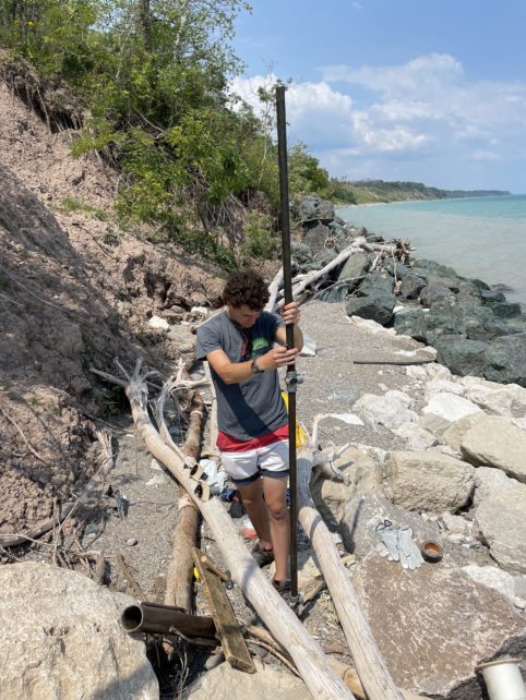
The scientists will gather data using a variety of technology that will allow them to monitor the effects of individual storms as well as help tell the bigger story. Using drones equipped with LiDAR, which uses laser beams to measure distances, they can quantify changes to the beach that occur due to storms. The research team has ready access to a LiDAR system developed by Ayman Habib, a civil engineer at Purdue, who also created a backpack-based system that can be used to perform high resolution mapping of the beach while walking along the shoreline.
But the best data may not make enough of a difference if community decision makers or even neighbors are at odds about how to manage Lake Michigan’s shores, so the project team includes social scientists who are focusing on the root causes of community conflict on this issue. The goal is to develop better community planning processes for shoreline protection and restoration.
Robert Enright, a UW-Madison psychologist, and his Ph.D. student, Lai Wong, will employ social justice circles, a scientifically verified program that works to address issues about which people feel strongly. This method convenes opposing parties in a dialogue with the goals of fostering understanding and mutual problem-solving.
For his part, Aaron Thompson, a social scientist at Purdue, will survey landowners in Beverly Shores to get a baseline understanding of their knowledge about coastal management and their attitudes towards past and possible future efforts to solve this problem.
“When lake levels were high last year, Beverly Shores residents did not lose any structures because they don’t have homes right on the shoreline,” said Thompson. “But, the community is potentially facing millions of dollars in infrastructure repair costs because sections of a coastal road washed away, along with the utilities underneath.”
The survey will include questions that address residents’ knowledge of and reactions to likely management options, derived through modeling of the sites with new data. The options will include nature-based solutions, which can be features that are completely natural, like planting native vegetation on dunes, and those that are “hard,” such as concrete structures like seawalls.
While most project activities were delayed due to the pandemic, Troy and his undergraduate students, Ben Nelson-Mercer and Hannah Tomkins, were able to use that time to analyze historical and recent aerial photographs of the Indiana lakeshore.
“We’ve been looking at parallels between the recent rapid increase in water levels from 2013 to 2020 with historical periods where the water level has also risen very rapidly,” said Troy. They went back to the 1960s, 80s and 90s to compare impacts to the shoreline.
Their results are preliminary, but they seem to be good news. “The shoreline erosion that we saw during this last period was pretty consistent with what we’ve seen in other periods where the water level has risen rapidly, which suggests that it’s a cycle,” Troy said.
They also noticed that, thus far, the shoreline position following the rapid water level increase in 2020 seems to be in slightly better shape than after previous high water level periods.
“Not to downplay the damage that we’ve seen along the Lake Michigan coastline, but there is historical precedent that suggests that the beaches will rebound quickly, provided that the water level comes down,” added Troy. “We find that beach rebuilding happens during the period when the water level is dropping. That said, it’s anyone’s guess where the water levels will go at this point, so we have to be prepared for all possibilities.”
Read more about how this project is going in Michigan and Wisconsin on their Sea Grant program websites.
Additional funding for this project is being provided by the Michigan Coastal Management Program, a NOAA Coastal Resilience grant and the Indiana Department of Natural Resources Lake Michigan Coastal Program.
